Strategy of modelling at IFREMER
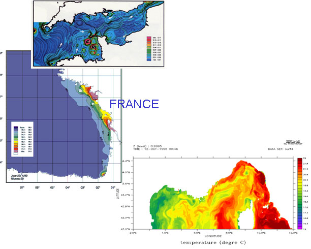
- MARS model is implemented for research and operational interests over the three metropolitan basins : the Channel, the Bay of Biscay and the North-Western Mediterranean Sea.
- Large scales are treated by operational institutes (MFS, MERCATOR), that provides MARS with initial fields and open boundary conditions.
- For the coarsest configuration (rank0), open boundary conditions for tides come from different data sets : FES2004, FES1999, Schwiderski
- If required, models are coupled offline or online (AGRIF package).
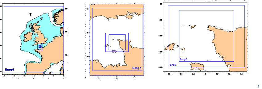
- A configuration can be splitted into several ranks, the spatial resolution increasing with ranks
- More than 30 configurations are implemented by Coastal Environment Laboratories